View Project
Read More

Aquatic plants are an important component of lake ecosystems. They produce oxygen during photosynthesis, provide food, habitat, and cover for fish, and help stabilize shoreline and bottom sediments.
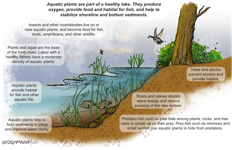
The distribution and abundance of aquatic plants is dependent upon several variables including light penetration, bottom type, temperature, water levels, and the availability of plant nutrients. Rooted plants generally grow at depths of about 20 feet and less. In deep lakes, rooted plants are generally restricted to near-shore areas and along drop-offs. In shallow lakes, plants can colonize much of the bottomland and may be prevalent across the lake.
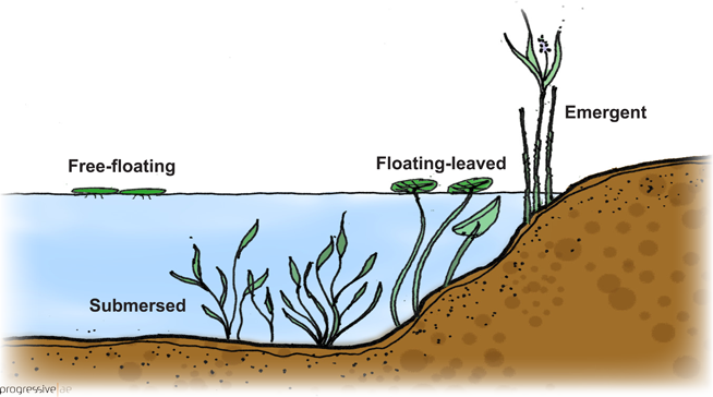
There are four main aquatic plant groups: submersed, floating-leaved, free-floating, and emergent. Usually, submersed plant species will be found in off-shore areas, while floating-leaved and free-floating plants are more common near shore. Emergent plants are found along the shoreline. Each plant group provides important ecological functions. Maintaining a diversity of aquatic plants is important to sustaining a healthy fishery and a healthy lake.


Invasive, exotic species are a statewide concern in Michigan. If left unchecked, invasive species can outcompete beneficial native plants and spread quickly throughout a lake. Invasive species of primary concern in Michigan lakes include Eurasian milfoil, starry stonewort, and Phragmites. Eurasian milfoil and starry stonewort are submersed species and Phragmites is an emergent species.
Aquatic plant surveys can be beneficial for a variety of reasons. An aquatic plant survey can provide important information about the type and distribution of plants, detect the presence of invasive plant species, and help inform management decisions.
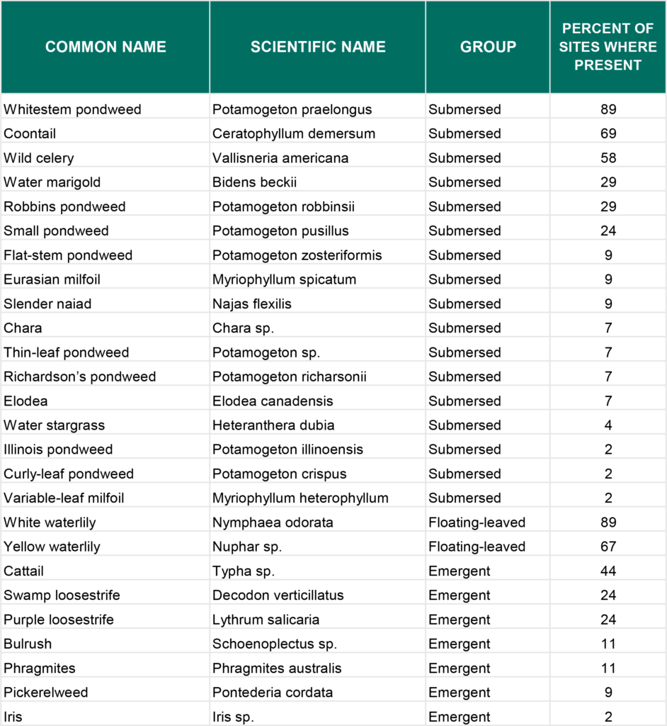
There are several aquatic plant survey methods. Some methods are relatively simple while some are more labor-intensive. With the widespread use of global positioning systems (GPS) in recent years, GPS-guided surveys are much more common. With this approach, GPS reference points or waypoints are established along the shoreline and the shallow-water portions of the lake, and plants are identified at each waypoint. This approach is referred to as the point-intercept method. Many lake scientists rely on this method because it can provide reliable data that can be analyzed statistically.

Once plant types at each of the reference points in the lake have been identified, the information can be tabulated and the percent frequency of each plant species calculated. Percent frequency is the number of sites (or percent of sites) where each plant species is found, as shown in the table below. Annual plant surveys can be used to monitor changes in plant composition and location over time.
One of the important uses of plant survey data is to identify the location of invasive plant species. With the use of GPS, herbicide treatments or other plant control methods can be targeted more accurately.
September 17, 2021
Another plant survey tool that is gaining popularity is hydro-acoustic plant mapping. With this technique, a specially-equipped depth finder is used to map the location of plant beds and measure the height of the plants in the water column. Hydro-acoustic mapping can be coupled with a point-intercept survey to identify plant types and locations.

Periodic monitoring of aquatic plants is an important element of a long-term lake management strategy. Plant surveys can provide valuable information regarding plant diversity, invasive plant introductions, fishery habitat, and lake health. In lakes undergoing plant control, plant surveys are essential to informing management decisions, and the efficacy and impacts of plant control measures.
Questions? Contact Paul Hausler, Water Resources Practice Leader.
References:
Madsen, J.D. and R.M. Wersal. 2017. A Review of Aquatic Plant Monitoring and Assessment Methods. Journal of Aquatic Plant Management 55: 1-12.
Reprinted with permission of The Michigan Riparian magazine from the Summer 2022 issue. Copywritten by the Michigan Lakes & Streams Association, Inc.

